My part of Tassie
Most Tasmanians would agree that the ‘apple isle’ is another world compared to mainland Australia.
My part of Tasmania (called Lutruwita in the Palawa language) is the top end of Tasmania, which covers Northern Tasmania and the Central Highlands, and some of the North-West and North-East of Tassie.
I have spent most of my time in the Meander Valley, with its fertile lush farmland and picturesque bluffs that dominate the landscape west-southwest of Launceston. The friendly country town of Deloraine is an art and crafts hub sitting on the Meander River with the majestic Great Western Tiers / Kooparoona Niara in the background.
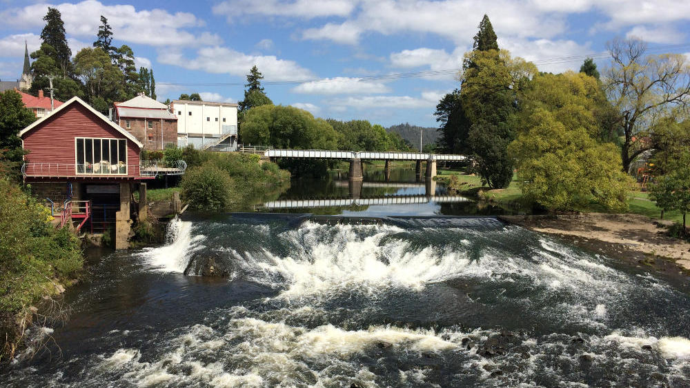
The Meander River flowing through Deloraine
The Great Western Tiers / Kooparoona Niara mark the start or end (depending on where you are) of the Central Plateau and Highlands, upon which Cradle Mountain and Walls of Jerusalem national parks sit, its massive length stretching across the heart of Tasmania.
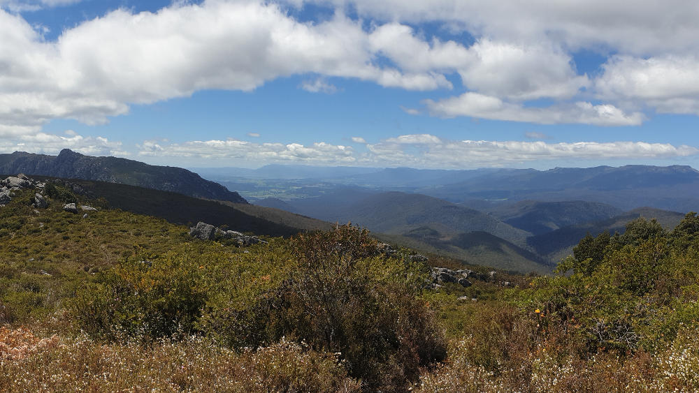
View of Mt Van Dyke and Great Western Tiers / Kooparoona Niara from Mt Claude
As a newly installed local, I discover my local area through work and play, and never tire of the silent yet constantly expressive presence of the Great Western Tiers / Kooparoona Niar. You don’t need to go far too find yourself enveloped in the beauty of its pristine world heritage nature.
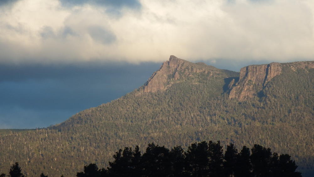
View of Mother Cummings Peak from Mole Creek Karst National Park
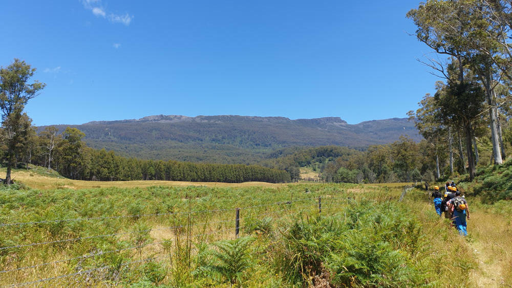
View of Mount Parmeneer on the Great Western Tiers / Kooparoona Niara from Sassafras Cave track
The area that I’m most at home in covers Mole Creek to Caveside, Western Creek to Meander, the Great Western Tiers / Kooparoona Niara Conservation Area, the Central Plateau Conservation Area, the Mole Creek Karst National Park and of course the stunning neighbouring Fossey Mountains outside Sheffield.
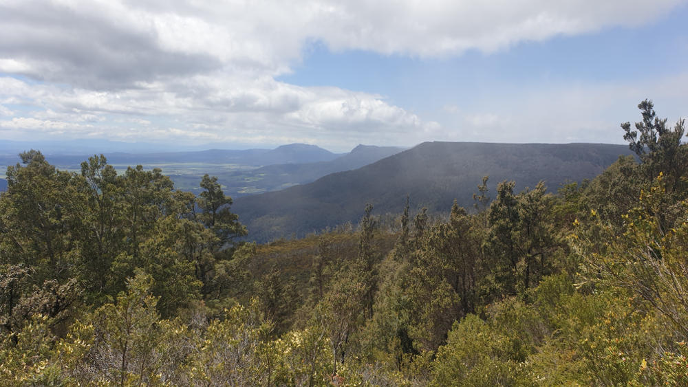
Looking at Quamby Bluff, Mother Cummings Peak and Nells Bluff from the plateau
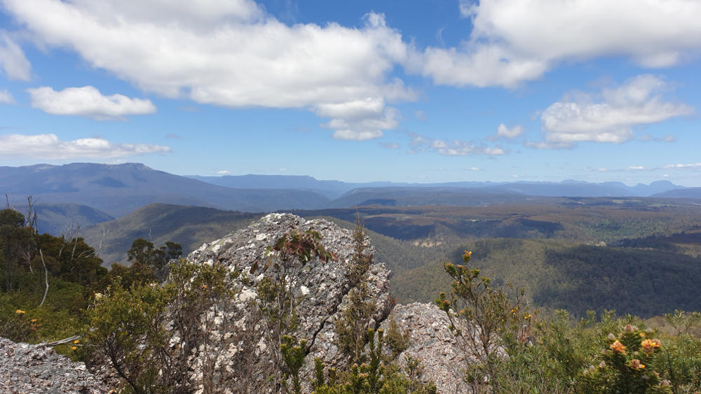
View of Western Bluff, Walls of Jerusalem and Cradle Mountain National Parks from Mt Claude, Tasmania
Another part of Tasmania I’ve also gotten to know, is situated east of the Tamar River and is known as the Upper Piper. It includes the beautiful Lilydale with Mt Arthur as a majestic companion, Mt Direction and the village of Pipers River. My discovery of this beautiful area has come through repeat house and farmsits.
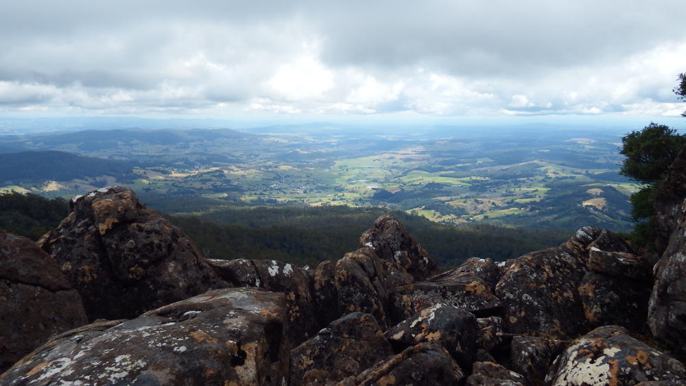
View of the Pipers River from Mt Arthur, Tasmania
I’ve also explored the area around Legana, Notley Gorge, Swan Point, Holwell Gorge, Beauty Point, West Head and Narawntapu National Park, spending many a night camping. :)
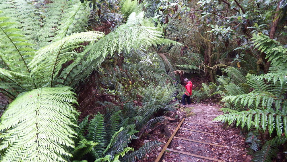
Going down into the depths of Notley Gorge, Tasmania
This part of the world has wonderful natural beauty and therapeutic treasures.
The rest of Tasmania
There are so many other places to immerse yourself in once you leave the north of the state. I love the wild and remote West Coast and Southwest. The relatively unknown West Coast Range, with the stunning Lakes Selina, Plimsol and Westwood, as well as the majestic Mt Murchison and village of Tullah, which border the western edge of the Cradle Mountain-Lake St Clair national park.
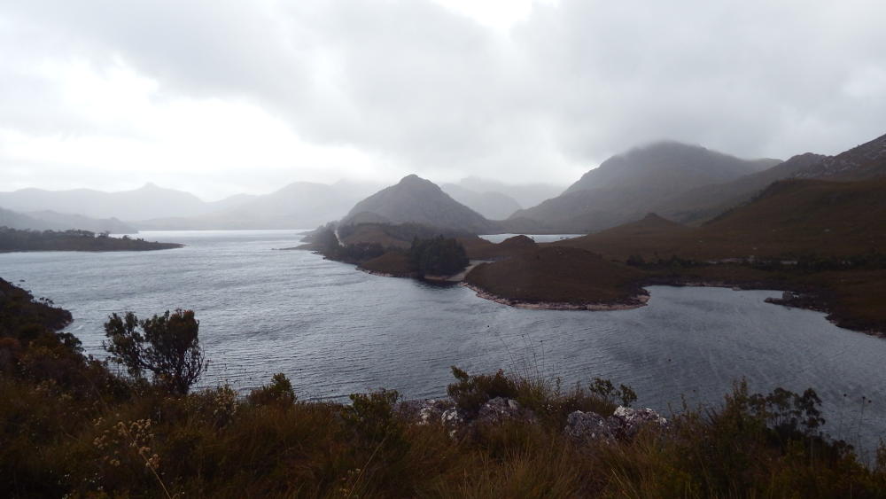
View of Lake Plimsol on Anthony Road, near Mt Murchison
The Tarkine beckons on the West Coast, with the Great Explorer Road leading down to Corinna, the Pieman River and Mt Donaldson. The Tarkine is a stunning haven of beautiful temperate rainforest with old world flora and fauna. The gateway towns of Queenstown and Zeehan herald the start of the Franklin-Gordon Wild Rivers protected area.
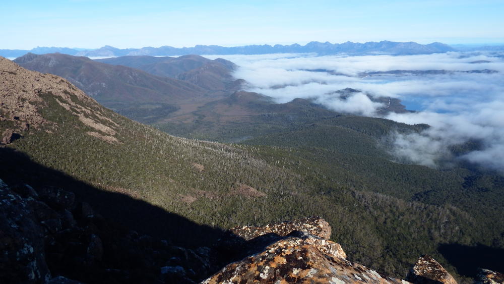
The view of Western Arthurs and Lake Pedder on the way up to Mt Eliza
From here it’s only a hop and a skip to the captivating Mt Field national park and the legendary wilderness of the Southwest with Mt Anne and Eliza, and the Port Davey Track that takes you to either the Western Arthur Ranges or deep south to Melaleuca. Don’t miss out on the astounding Moonlight Ridge near Mystery Creek Cave which connects with the South Coast Track.
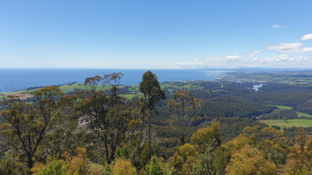
View of the Bass Coast from the Dial Range
On the Northwest Coast not far from Penguin and Ulverstone is the impressive Dial Range, the Leven Canyon and fabulous Gunns Plains (and its caves) that lie in wait behind the Dial’s silent peaks.
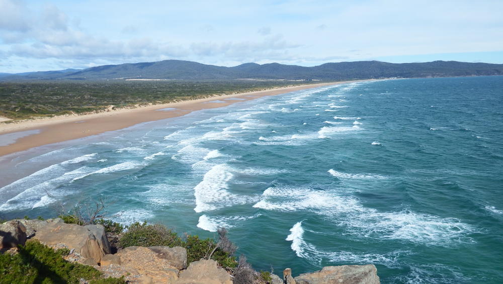
Badger Beach in Narawntapu National Park
Near Launceston is the amazing natural sanctuary that is Narawntapu national park, home to abundant nocturnal wildlife in the form of Tasmanian devils, pademelons, bandicoots, spotted quolls and wombats.
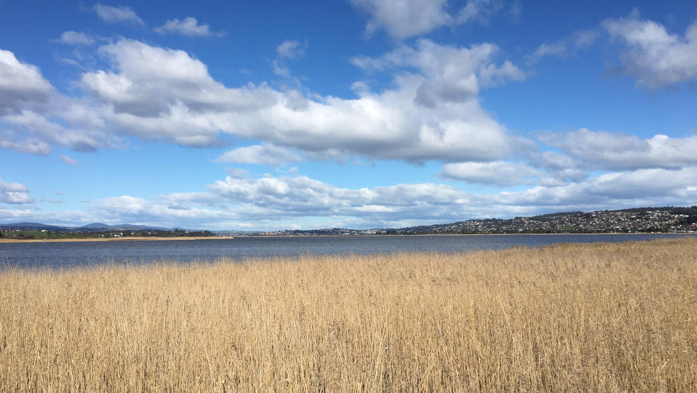
The view of the Tamar River from Tamar Island outside Launceston
Closer to home is the scenic Tamar River, serpentining in from the Bass Strait to the city of Launceston, with plenty of opportunity for healing and reflection. Tasmania’s second largest city is surprisingly home to pockets of pristine nature such as Travellyn Reserve, Notley Gorge, Tamar Island Wetlands and Holwell Gorge.
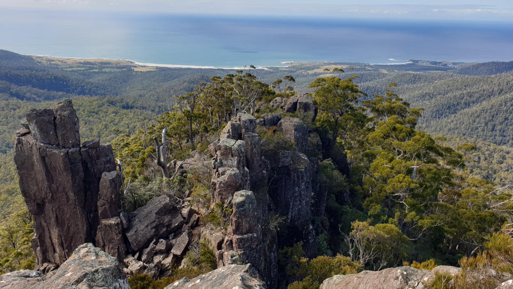
Looking at the East Coast from St Patrick’s Head, outside St Marys
Eastern Tasmania surprises with rainforest and mountains such as the Blue Tiers with views down to the East Coast.
My part of Norway
Norway has a long tradition, culture and history of outdoor life and connecting with nature. It is one of the few countries in Western Europe where you can dive into genuine wilderness and really be alone.
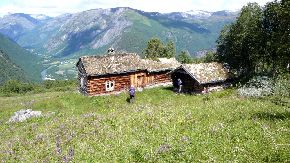
Hiking down to Gjøra in Dovrefjell-Sunndalsfjella national park
To begin to understand Norway’s intimate relationship with nature, a good place to start is by familiarising oneself with the Norwegian philosophy and privilege of the ‘Right to Roam’.

Camping at Per Gynt hut in Rondane national park
This respected and ingrained collective acceptance of having access to nature everywhere, is what laid the foundation for Norway’s fantastic, elaborate and well maintained network of marked trails and huts.
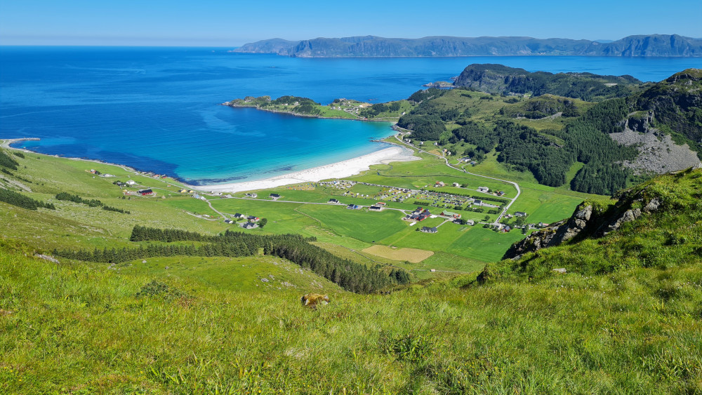
Looking down at Refviksanden beach in Nordfjord
The part of Norway I lived in (inland Norway) is a crossroads. Around every corner, there is a story waiting to be told. Whether summer or winter, it is possible to hit the trails and follow the history. My passion is discovering and exploring Norway’s pre-Christian roots and culture. The mountainous and forested heart of Norway is full of timeless sagas and legends.
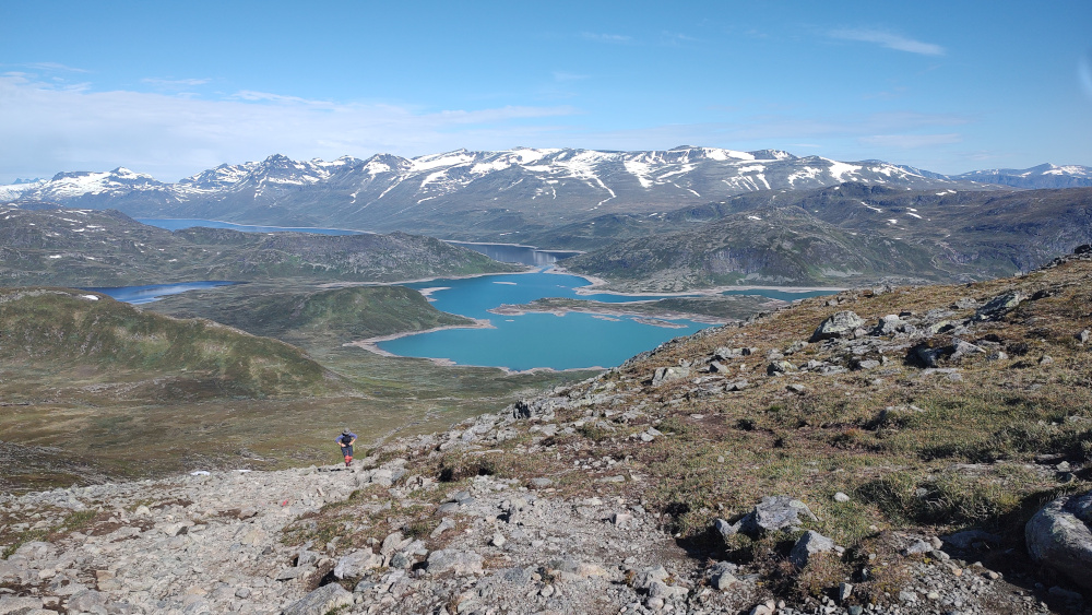
The view from Bitihorn over Jotunheimen national park
Central and Eastern Norway offer some of the very best multi-day hiking opportunities, taking you through inland Norway’s most spectacular regions. Would you like to discover Central Norway? Hike the highland and border (to Sweden) counties of Oppland and Hedmark (now Innlandet), along hundreds of marked trails crisscrossing and connecting the two, and experience the unique beauty of Norway’s inland national parks?
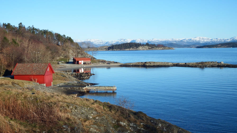
Winter in Stavanger on the West Coast
I offer you the opportunity to hike some of the more popular long distance trails here:
- Finnskogleden, hiking the mystical Finnish forest
- Kongevegen over Filefjell, journey to the home of the giants
- Pilegrimsleden, the Pilgrim’s Way from Oslo to Nidaros
- Rondanestien, into the spiritual heart of Norway
- Skarvheimen, connecting alpine and fjord Norway
I also invite you to hike some of the less popular but nonetheless scenic hiking trails in and beyond Central Norway:
- Den Stavangerske Postvegen, from Stavanger to Bergen on the old postal route from 1600s
- Fossestien, hiking the Waterfall Path in Gaularfjell (day hike)
- Landåsbygda Rundt, along a 1,000 year old bridle trail (day hike)
- Østerdalsleden, from Sweden to Nidaros on the Pilgrim’s Way
- Valldalsleia, from Fjord to Fjell on the Pilgrim’s Way
Norway is a country best explored and discovered on foot. It is where you come if you want to experience a country with a deep and enduring nature culture.
All the famous places where the tourists go - Hardangerfjord, Lofoten, Preikestolen, Jotunheimen - they are without a doubt breathtaking and stunning, but what you see there, the same thing is available virtually everywhere in Norway.
There are so many beautiful fjords, so many beautiful mountains, so many beautiful beaches - so many beautiful Norwegian idylls. This is what Norway is all about.
Fortunately it’s still possible to find lesser known places, relatively untouched by tourism, which you can experience wholly and fully as nature intended.
Avoid the tourist traps; avoid the saturation and soullessness of social media driven tourism. Experience the real essence of Norway on foot outdoors in unforgettable nature.
Would you like to join me in 2026 on a hike in Norway? Would you like to try one of the marked trails above or have you own route planned for you based on your wishes? Please get in touch with me to discuss your dreams, goals and ideas.
Any questions, please feel welcome to contact me on +61 (0)448 381 306 or by email.
Go to Top ↑
